岩国 · Iwakuni, Yamaguchi Prefecture
Hiking the Mountain at Kintaikyo
A complete guide to safety, techniques, and tips for ascending Mount Shiroyama — from the historic five-arch bridge to Iwakuni Castle summit at 300m elevation.
About the Trail
Mount Shiroyama &
the Kintaikyo Trail
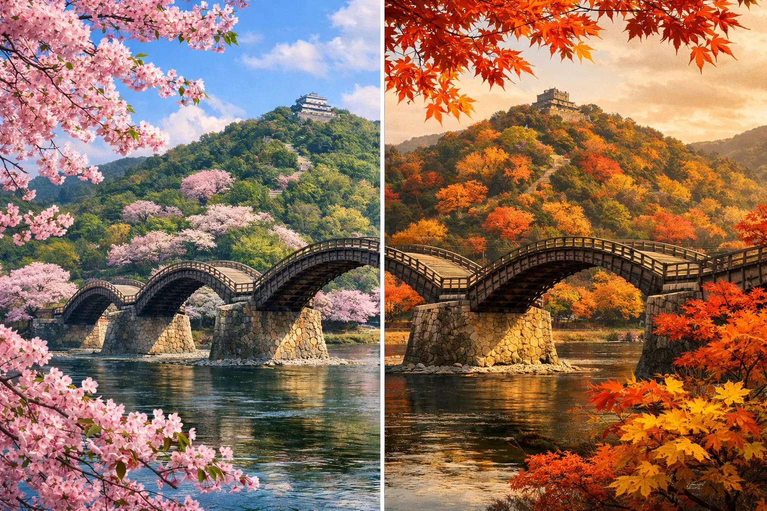
The mountain at Kintaikyo — officially Mount Shiroyama (城山) at 300m elevation — rises directly behind the iconic five-arch wooden Kintaikyo Bridge in Iwakuni, Yamaguchi Prefecture. The Iwakuni Recreation Forest covers 278 hectares of this mountain, a natural forest of evergreen broad-leaved trees including chinquapin and oak, home to over 210 tree species, 350 flower varieties, and 60 species of wild birds.
The mountain has been a protected nature reserve since the Edo period, when the Iwakuni Castle was demolished by shogunate order and the mountain was closed to public entry — preserving its remarkable biodiversity. Today, hikers can ascend via multiple routes, from a gentle paved road to a traditional forest trail with steep switchbacks.
The trail is rated Moderate by AllTrails, with 343m of elevation gain over 6.6km. The best hiking season is January through May, with spring cherry blossoms making the trail particularly spectacular in late March to early April.
Getting to the Summit
Trail Routes
Ropeway Route
EasyTake the ropeway from Kikko Park (near Kintaikyo Bridge) up 200m to near Iwakuni Castle. Suitable for all fitness levels, families, and those with mobility limitations.
Paved Road Trail (Tosenji Temple Route)
Easy–ModerateA paved road accessible from Tosenji Temple leads to the summit. Easy walking surface but a steady incline. Good for those wanting to hike without technical terrain.
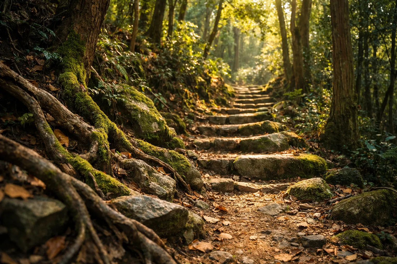
Forest Trail (Iwakuni Art Museum Route)
ModerateA traditional wooded trail starting next to the Iwakuni Art Museum. Steep in parts with switchbacks. Offers the most authentic mountain forest experience with views of the city.
Full Shiroyama Ridge Trail
Moderate–HardThe complete trail from Iwakuni Station area to the castle summit via the full ridge. 343m elevation gain. Best for experienced hikers seeking the full mountain experience.
Stay Safe on the Mountain
Complete Safety Guide
Pre-Hike Preparation
Trail Assessment
Difficulty Breakdown
The Kintaikyo–Shiroyama trail presents a balanced challenge. Steepness and footing are the primary technical demands, while navigation and exposure are relatively straightforward on the main routes. Weather risk is moderate, particularly in summer and typhoon season.
Plan Your Visit
Seasonal Guide
- Scenery
- Safety
- Crowd Level
- Difficulty
Spring (March–May)
- ·Cherry blossoms (sakura) peak late March–early April — one of Japan's top 100 blossom spots
- ·Comfortable temperatures for hiking
- ·Highest visitor numbers — arrive early to avoid crowds on the bridge
- ·Watch for slippery surfaces from spring rain
- ·Trail conditions generally excellent
Summer (June–August)
- ·Extreme heat and humidity — risk of heatstroke
- ·Hike early morning (before 9am) and carry extra water
- ·Hornet activity peaks in summer — highest risk period
- ·Typhoon season June–October — check forecasts carefully
- ·Lush green forest is beautiful but trail can be very humid
Autumn (September–November)
- ·Spectacular autumn foliage (koyo) — reds and golds throughout the forest
- ·Ideal temperatures for hiking
- ·Bear activity increases in autumn as they forage before winter
- ·Shorter daylight hours — plan to finish by 4pm
- ·Momijidani (Maple Valley) in Kikko Park is particularly beautiful
Winter (December–February)
- ·Lowest crowds — peaceful mountain experience
- ·Occasional frost and ice on trail surfaces — traction devices recommended
- ·Rare but possible snowfall — check conditions before going
- ·Short daylight hours — start early
- ·Clear winter days offer excellent views from the summit
Trail Topography
Elevation Profile
The full Shiroyama trail climbs 343m from the Kintaikyo Bridge area to the summit. The steepest sections occur in the upper third of the trail, between the mid-ridge and the summit. The forest trail route is more direct and steeper; the paved road route follows a gentler gradient.
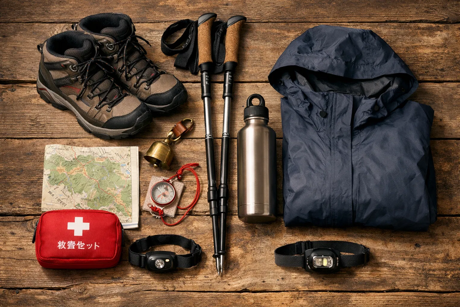
What to Pack
Essential Gear Checklist
If Things Go Wrong
Emergency Information
GPS location transmitted automatically. For mountain emergencies and getting lost.
For medical emergencies, injuries, and rescue. Available 24/7.
Multilingual tourism assistance. Available 24/7 in English and other languages.
If You Get Lost
- 1.Stop immediately — do not continue deeper into uncertainty
- 2.Return the way you came until you recognize your location
- 3.If you cannot find your way back, stay in place
- 4.Signal for help: 3 whistle blasts = universal distress signal
- 5.Call 110 (police) — your GPS location is transmitted automatically
- 6.Conserve phone battery — airplane mode between calls